7 Continents 5 Oceans Map Presentation Template


Product Description
Simplify worldwide information and make global topics easier to understand with this professionally created 7 Continents 5 Oceans Map template. Designed for teachers, researchers, corporate teams, students, and training professionals, this template offers a visually engaging way to present location-based information and international insights.
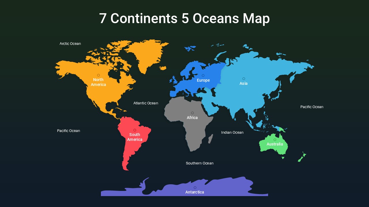
The template features a colorful world continents and oceans map that clearly identifies the seven continents and five major oceans. Different color sections help separate regions visually, allowing audiences to understand geographic divisions quickly. This approach improves readability and helps presenters communicate information without overloading slides with excessive details.
The slide design also helps build a better presentation story. Users can begin with a global overview and then gradually move into region-specific topics. For example, educators can explain geography concepts, climate patterns, and population studies. Likewise, businesses can present international operations, market opportunities, expansion plans, or regional performance data. This flow creates a natural transition from broad global information to more detailed insights.
The world map presentation template includes editable content areas that allow users to personalize labels, colors, icons, and information sections according to their goals. Whether presenting educational content or business strategies, the design keeps information organized and visually balanced. This template editable in PowerPoint & Google Slides works effectively for geography education, international business reports, travel discussions, demographic research, and global planning presentations.
Frequently Asked Questions
What are the other use cases of this 7 Continents 5 Oceans Map template?
This template can support many presentation needs beyond geography lessons. Users can create global market reports, cultural studies, travel presentations, population analysis, climate research discussions, international business strategies, project planning sessions, and worldwide sales or operational reports.
Who can use this world map presentation template?
Teachers, students, researchers, consultants, business teams, travel professionals, and organizations can use this template. It supports anyone who needs to present worldwide information in a structured and visually engaging way.
What is a 7 Continents 5 Oceans Map template used for?
A 7 Continents 5 Oceans Map template helps users visually explain world geography and location-based information. It supports educational presentations, international reporting, global analysis, and regional discussions by organizing information in a simple format.
Login to download this file
What do you think of this template?
-
Category:
Infographics -
-

-

Aspect Ratio: 16:9
-

Item ID: SPT0764
-

Designed by: Niranjana
-

Color
Related Templates
-

-

-

-

-

-

-

-

-

-

Creative Mind Map Infographics Presentation Template
Google Slides
-

-